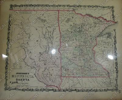
Minnesota and Dakota Territory: 1861. Material: paper. Size: 14 1/2" W. x 18" L. Description: black, white, pink and green - tinted and escapsulated map of Minnesota and Dakota Territory - printed fluer-de-lis border.
From "Johnsons Family Atlas" - published in 1861. Minnesota